Don’t Worry, be Hampi!!
January and February were very hectic days for me. Due to extensive business travel, I was not getting time out to explore new places. I was even working Saturday’s and Sunday’s at office. I even went back to Uttarakhand, but this time it was for business purpose to Rudrapur, just 30 kms short of Haldwani.
One more reason for not being able to travel was that there was no any public holiday falling in these two months apart from the republic day holiday.
The next holiday was directly coming in the month of March, which was of Holi and it was falling on Thursday! No sooner than March month started, I had applied leave on Friday which made a perfect 4 day plan for exploring Hampi.
Only three of us were there for the trip at the beginning when we started planning. Myself, Ganesh and CSK sir. Earlier we were going to Maheshwar Temple in M.P but we later on changed the venue to Hampi, Karnataka. Hampi was little faraway from Mumbai as compared to Maheshwar.

But, as it happens everytime, CSK sir unfortunately had to cancel off the trip due to business tour suddenly coming up on that date. Just two of us were remaining for the trip now and eventually Ganesh too backed out of the plan saying it was not worth going this far with just two of us going on the ride. But, since the ride was fixed quite before, I even had done making the tour stickers. So, cancelling the trip at this moment was not an option and hence, I decided to ride solo.


There was not much packing to do. I ensured that I had all the necessary things ready, such as my camera gears and the basic things required for every trip. Hampi was not planned in detail. Just a day before, I took a printout of the places to visit from their official website and that was it. I was going to make that as my bible for the next 4 days.

Day 1
The distance was around 750 kms and hence I started early around 4am. I had to get there before it got dark. I reached Pune around 8am which was my first break, though, I actually had breakfast some kms ahead after crossing Khambhatki ghat section on the NH8 highway.


After around 9am it started to get really hot, being start of summer season. I was continuously taking hydration breaks which included water as well has fresh sugarcane juice. There were many stalls of it lined across the side of the road and it was really confusing as to which stall to stop. I was getting a big mug sized portion at a decent amount of 15 rs. The heat was such that the thirst could not be quenched with just 1 mug, at-least 2 were required.

I crossed Kolhapur around noon. Till now, on this section of NH8 highway, I had drove only till Nipani which is around 30kms ahead of Kolhapur. In 2015 we had gone to Goa and had taken the Nipani route towards Goa. I could barely remember the roads but one thing I knew were that the roads were great to drive on. After Nipani, everything for me was going to be new and first time with me behind the handlebar.


The heat intensity went on upward trend as the day progressed. With me, packed in all those tight riding gears, I was losing body fluids through dehydration, though I had opened up the jacket zippers for ventilation. From Belgaum onwards, I was looking for a decent hotel so that I could stop and have lunch but for my luck part, I could not. This went on till Hubli after which I had to divert from the main road and head towards the interior village roads. There, I stopped myself purposefully as it had got quite late for lunch. The time was around 2 pm. There was a small shop at the corner but I suspected that it was providing a decent lunch. Upon inquiring, I was told that only Idli and Wada was available at this moment of time which was also made at some different hour. But at least, this was better that having nothing. So I ate around 4 pcs each of Idli and Wada and finally finished it off with a tea! Having the tea, made me more aware and made my mind more focused to cover the remaining distance.


I was back on road at around 2:15 pm and still had 160 kms to drive. I thought I was well on track to cover the remaining distance but I was wrong. There was no NH road and I was driving on SH which was in utter bad condition. On top of it, the entire stretch till Hampi was broken, as the roads were being laid into concrete. Almost 80% percent of the roads were under construction and only for some portion I could speed myself up. There were traffic of heavy vehicles as there was a mining ground nearby and the dust pollution due to that was intense. My average speed was around 40-50 kmph. This went on till I reached Koppal after which I was greeted with some good roads to drive. The only thing which left me wondering was that till now I had not seen a single signboard saying the word Hampi and the direction leading towards it and here I was, coming closer and closer. All I could see was the word ‘Hosapete’. Hampi is a part of Hosapete and indeed a small town but, I thought it being a heritage site, it must have been well marketed and directed. Alas! I was at the heritage site of Hampi and with the help of google maps directed myself to the main centre where I could find a hotel for myself. I knew that Hampi was distributed on both the sides of the the bisecting Tungabhadra river but, I was on the main side where almost all of the heritage sites are present. The other side, people call it the Hippie side of Hampi!

The major setback for this trip was that my bike USB charger had went for a toss. It was not working which only made matters worse. I think I had procrastinated on the issue too much. I knew that something was wrong with the charging, but owing to my heavy business travel, I didn’t quite manage to find time to work on the issue and instead resorted to the battery bank. I had kept my mobile brightness to minimum in order to conserve the phone battery for long 750 kms, with all 4G data ON including taking photos and videos during break. Also, I was listening to my music via Bluetooth. There was not much use of the mobile for the navigation purpose as I was knowing the roads thoroughly, but after Nipani, as I entered unknown territory, I had to use the mobile often to see if I was going in the right direction.
Hampi town centre was few kms away and my phone battery was hovering around 3%. The sun was going down below the palm trees amidst paddy fields and the whole sky was painted in golden hue, as if the sun had painted the whole sky with its own colour. The time was perfect for a photograph. It was a trade-off between conserving the remaining battery for finding hotel and not missing the golden chance to click a beautiful photograph. I went for the later and managed to click some awesome shots which made my battery fall to mere 1%. I also managed to make a small video for my Vlog in the meantime. My GoPro had died as for some reasons the portable battery charger was not working properly. The time was around 5:30 pm

I quickly hopped onto my bike and went ahead as still few kms were left. Google maps dropped me at a place where there was huge crowd on all the sides. It was a long weekend and such traffic was expected. Mostly people from nearby places had come to visit as seen from their attire. I could also spot some MH12 vehicles along the way. I had stopped at the junction where the roads bifurcated into left and right. Being new to the place, I just stood there and was trying to make sense of the situation hoping to find someone who could help. I was in view of the Hampi monuments and already started to like them.
Upon looking here and there, I saw one man in traditional south Indian dress approaching towards me. He knew I was looking for help. I asked him about the availability of hotel for which he replied ‘Yes’. He told me there was availability of hotel and guided me with direction. As I went in that direction as instructed by him, I saw him approaching from behind. I waited for him as I was confused as to which way he had told exactly. I now was driving at his walking speed as he led me at the door steps of the hotel. Having experienced hot and humid climate on my way here, I was looking to opt for a hotel which was having an A.C. I was also tired having ridden odd 750kms. Was mainly tired because of the roads. But, the guy told me that none of them were having A.C. rooms which were vacant at that point of time and so I had to settle for a room which was having just a table fan. The deal was done for 300 bucks per night.

The bike was parked right outside the hotel gate. The deal was perfect considering the condition of the room and the facilities which included a private bathroom. He gave me the room keys and left me alone. After a tiring riding day, I knew a cold refreshing bath was going to solve the problem. I freshened up myself and changed myself into loose clothing. It was dark by the time I locked the room and went out. My room was near the marketplace and so, the time was spent looking at the various shops and their offerings. The Virupaksha temple was nearby and I thought of going inside and have a look. This was my first monument to visit in Hampi. The tomb at the entrance was lit in golden colour with a bright lamp attached at the top of it which was emitting light like a strong beam of flashlight. Before entering inside, I clicked some pics.

There was a huge number of crowd gathered inside the open premises of the temple even at this moment of time. I just strolled around knowing that the real exploring was going to start from tomorrow. I had just ventured out to free up my legs and knee joints after that heavy stationery 750kms of riding. I was too tired to walk more and so headed back in the direction of my hotel. I knew I had to start the day early and hence had to sleep early. Also, I was getting hunger pangs and it was the perfect time for dinner. I managed to locate a hotel in the market place and went straight to it.
Browsing the menu took time for me and an equal amount time for finalizing the menu. Most of the things were not available and could not be made owing to power cut the whole day. Also, whatever we ordered, they were going to make it fresh and from the start. I ordered a full sized special Thali and as I was told that it was going to take some time before the order was ready, I ordered a bread omelette and a cool lassi for starters. I could not, in fact my stomach was not going to wait till the main menu was ready.

What I liked in particular about the hotel was that it was designed keeping in mind the typical backpacker type of crowd. There were no flashy lights, a sooth country music was playing at the background. The chairs and tables were limited and occupied a very small space. Majority of the area, the sitting system was like, there was a small 10″ height table, the same design which Chinese and Japanese people use for eating their dinner. There were small beds placed on both the sides of the table along with head rest. On top of the table hung a small colored light hung straight down from the ceiling. Each table had a different colour combination and it set the perfect mood for the night. Also, there was not much crowd that moment apart from 2-3 occupied tables.
Finally the main course came and I just finished it in no time. It was time for some good sound sleep. The Map of Hampi was ready at hand and all the camera stuff were on charge mode. I downloaded all the media content which I had shot for the first day in to my portable hard-disk. I Set the alarm for 6am and slept peacefully.
Before closing, I had glanced a thorough look at the map and decided what my first place for tomorrow would be. There were few vantage places where the view offered a great place to experience the sunrise.
All set, my eyes shut itself.
Day 2
I had set the alarm for 6am. By the time I got out of my bed, I could see it was bright outside. I was completely taken for a toss. Had completely forgotten the astronomy pattern during the summers. The days are longer and the nights short. But, it was not until 7 am that I moved out of my room to start my day. The Sun had come up nicely and I had missed my sunrise by a large margin. This was inferred by the shadows of the nearby buildings cast on the ground. As per the plan, I was to go to Mathanga hill or otherwise popularly known as the sunrise point. I checked the map and it was around a min drive from my homestay. I stayed with the plan and headed straight for it. I parked the bike at the base and started a good 15 min trek to the top. The steps were not artificial and instead, they were rock cut at the spot itself. The hill was a huge pile of big boulders arranged randomly, you can say. I wondered, and was too much curious as to how these boulders came into this place in the first instant. They were too big to get placed at this spot by some mechanical means.


After spending quite me time at the top of the Matanga hill, it was time to come back down. Another reason was that I was damn hungry and it was time for breakfast. At around 9:15 am, I reached base and headed straight to the cluster of hotels which were around 100 mtr from my current location along the road from where I came.


As per my downloaded map of places to see in Hampi, I started with Route 1 which was nearest to me. Route 1 has total of 14 places to cover and out of which I had just completed one of them which was Matanga Hill.
Details of Route 1 are below and also at the entire complete Map attached above.


I salute to the person who designed the map. The map is carefully designed to cover all the places which Hampi offers and the routes are divided in such a manner that you dont double walk any of them. All of them can be complete in a sequence without falling the same route again. God only knows what would have happened if I would have not got my hands on this map. The Map presented above is designed to cover all the places for 3 days. Similarly, for people having lesser days to explore, there is a map designed for them too, only thing is that the number of places to visit reduces. The Map is available on their website.
Link:
3 Day Hampi Itinerary
After my breakfast, I moved onto my next destination as per the route.


I was moving towards place 13 and 14 which were the last in the Route 1.


After that, I moved on to the last temple of Route 1 which was the Uddana Veerbhadra Temple.


In the route 1, I could not find the 10th monument which was the Saraswathi Temple. Even could not locate it with Google Maps! So, I decided to let it go and move on and started my way back to the Virupaksha Temple where my bike was parked. I was just tracing back my path from where I had come.
At Hemakuta hill, I spent more time as there were many monuments there which required close attention.


I reached the place where my bike was parked. Out of the Route 1, I decided to cover the main Virupaksha Temple and its adjoining area ‘Manmatha Shrines, Tank and Ghat’ later. So now, out of the list from Route 1, I was not able to find one, I gave up finding second and the last one which was pending was the Monolithic Bull, which I decided to take a look after Lunch. I was literally dying of hunger.
At the same time, I was running out of space on my Mobile and I needed to charge my GoPro too! So, I went directly to my room and made the necessary transfers while I had a good bath. After the heavy walking under the scorching Sun, I was drowned in my own sweat!
The transfer was still happening even though I came out from the bathroom. Having no time to sit and wait for the copying to get complete, I dragged the setup along with me to have lunch at a nearby restaurant. I had the same kind of food which I had the previous night. Special Thali! The copying was still going on. The lunch took time to get prepared while I was the only visitor at this moment of time at a hot and lazy afternoon.
It was a really heavy afternoon lunch for me considering my diet. I overate. I quickly hopped onto my bike and went to my room again to collect all my remaining stuff back. It was really tedious to carry all those recording equipment around myself. I had a GoPro mounted on my chest, A sling bag around my shoulder, DSLR hanging from my neck and a mobile phone in one hand. I went straight to ‘Monolithic Bull’, which was situated near to the base of Mathanga Hill.


So Route 1 was done, with 3 places yet to be explored and 1 place unable to find. With high hopes and excitement, I went onto route 3.
Route 3 had places numbered from 15-42 and the places are given below.


Seeing the number of places, I was bit confused as to where to start. Whether to start from serial number wise or not? Or just random number based on its nearness to my location. I went for the later. I took a left turn from the main road and head inside. The first monument which I stumbled upon was number 16 one, Underground Siva Temple.


Band tower was also there in the same premises but the entry to it was locked.


Next in line was the Hazara Ram Temple which was close to my current position. The time was nearing 6 pm now. I entered the temple from one of the broken walls at the back. Entering from the front gate involved heavy circling the temple which would have consumed time.


Did you notice the square holes made on the floor of the pavilion? These were used to erect the poles which acted as a support for the overhead canopy. This is huge hall having a massive floor area. Probably, this was used for all the cultural programs of that time.


The large stone trough was used to keep water which in turned helped the horses and other animal to drink water from it easily.


Mahanavami Dibba was the last place for that day as it was way past 6:30 pm. As per the HAMPI security guards, all the temples get closed by 6 pm. So, the person would be solely responsible for himself had he gets locked out in one of the temples. They were ensuring strict checkup of the area and ensured that no one was left behind. It was pitch dark by now. There was no other option to head back home and have a cold bath. All the heavy lunch which I had taken had mysteriously disappeared somewhere. I was again hungry now but not until I felt fresh.

Of the 28 places in Route no 3, I managed to cover 9 places today. I was satisfied having covered most of the places in Route 3 as well was feeling tired. I knew tomorrow was going to be a much bigger day than this. As per my fitness watch, I have waled in excess of 20K steps today, an altogether, different feat for me!
After I freshened up myself, I went looking for options in dinner and finally settled for a Masala Dosa and after that tea!


Before going to bed, I had a quick stroll around just to free up my legs and then without wasting much time went to bed directly. The alarm was already set for 6am and the copying of the today’s generated data was in progress.
I could hear the rats running across my roof and it worried me as I was sleeping naked owing to no A.C. and too much heat. Soon, my mind numbed my hearing senses and I dozed off!
Day 3
I started off early and headed straight to Route 3. My first point was the Noblemen’s Quarters which was serial no 17 on the list. There was a gated entry to the place and most of the quarters were in ruins. I mean, there were not even walls to the quarters. They were just reduced to 2D plan. To view the place, there was a heightened corridor and the artificial steps helped you to get to the top. From here, you had the 360 deg view of the places. There was not much to see and I immediately moved onto the next place.


Next in line were the Granaries, which as per the map were located next to the Noblemen’s Quarters. I tried hard finding the display board, but failed and hence I skipped it. They was no any kind of structure to be found nearby, even though I was standing at the right place as per the map.

I then went on to serial no 39, which was the Saraswathi Temple 2.


Then I moved on to serial no 40 which was Octagonal Bath and it was nearby the Saraswati Temple.


Chandrashekara Temple, which was at no: 38, was seen nearby the Octagonal bath only as per the physical map and the google map.


Next in line was the Queen’s Bath at no: 37 but the gates to it were locked out and I had to witness it from the outside only.


Then it was Yellamma Temple at no: 31. I headed in the direction at which the small black was located on the map. As I approached the place, I could see the information board for the temple, but I could not see the temple. There was a small structure nearby, but I mistook it for something else. I went walking ahead constantly checking my google maps but, the temple could never be found. I retraced my steps back and concluded that whatever I had just seen 2 mins back was indeed the sample temple. But, it too was closed at that moment. There was not any detailed information board explaining the temple history.


After that, it was the Ranga Temple at no: 30.


It was then Zenna enclosure at no: 26. It was a large enclosure with high walls and many monuments were inside it. I had to park my bike outside and there is an entry ticket to the place, around 40 rs I guess. This ticket entitles you to visit the Hampi archaeological museum for free.


Just ahead of the Zenna enclosure were the Elephant stables at no: 25.


After completing the Elephant Stables, I went ahead in the direction of sr. no 28 and 29. They looked like little far from my current place, a little off location. Determined, I went in the direction of the little black dots. Along the way I found numerous temples which were in utter bad condition. Some were completely fallen, some were about to fall and for them artificial braces were applied to support the heavy structure.


Along the way, I was able to locate the sr no 28 and 29 temples and after walking for so around 800 mtr I came to this huge structure which probably resembled like an entrance of that time. As I went more ahead, I was staring at the metallic fencing, signalling the end of the Hampi territory. I turned back and traced the same route back till the ticket issuing office.


The time was now around 9:30 am and I was damn hungry. My routine breakfast time had long elapsed. But, here I was in the middle of the ruins and there was no any hotel to be found. There was only a single shop behind the archaeological museum which was selling water and small stuff like biscuits, wafers and stuff. He did not have any fresh food. Everything was packed. There was nothing I could do about that and so I had a special breakfast of ‘Little Hearts’ sweet and salty shaped biscuits. I had around 2 packets of it and washed it down with a cold water. It was still early in the morning but, the sun was at its extreme by now.

Almost all the places I had covered in this area and only a single one was pending which I decided to go after I finished having my breakfast. The place was ‘Tenali Rama Pavilion’. I was super excited to see as I had heard quite a lot stories of the gentleman during my childhood and wished how it would be to see his pavilion up-close in real and get a feel of it.
At the first, I had trouble finding it as I was confused whether the structure I was looking at was really Tenali Rama’s pavilion. Since, almost all the structures were having the same construction pattern, it was difficult to differentiate. Also, there was no any sign board or information board of the place. I was all dependent on the accuracy of the map in hand and most importantly the scale section. It helped me judge the distances.
The main issue leading to the pavilion was the road. It was not visible clearly and I had to spent quite some time in the scorching heat to locate it. The pavilion was sitting on a little height atop a small boulder and hence the access was natural and not man made. Somehow, I managed to reach at the place and climbed upstairs.


I came back to the parking lot and next to it was the Archaeology gallery and office at sr no 24. I went inside and it was all outside display of the stone figures collected and found during the excavation. Most of the figures already looked familiar to me as I had already seen them in the temples. Some were new to me and I inspected them carefully and reading their information which was written at the bottom. The figures ranged from a variety of sizes from small palm sized to big size, comparable to a size of a full grown adult.


After a brief period of time I exited the display gallery and it was time for the next place. But, before I could get on my bike, I had a quick refreshment of tender coconut, which gave me some relief from this extreme heat. It must have been more the 40 deg Celsius.

Next place at sr. no 32 was Pan Supari Bazaar which was closest from my standing place.

During that times, this must have been a trading place for the fellow merchants. As such there was nothing to be seen like a normal bazaar we see in today’s days. Only some structures and a tall pillar were present on the site. I was expecting the structures to be similar to the ones I saw at Krishna Bazaar but, this was completely new to me. I had envisaged small repeating structures where people sat and traded. But, it was more of a open kind of bazaar. I think, they must have been sitting on the ground directly. I clicked pics of whatever I could get and left the place.


Till now, I had covered almost 90% places in route 3. The only exception was Sr.no 20 which were the Granaries, and I was unable to locate it. Maybe, you people can take help of guide the next time you plan to visit Hampi.

Since, I was closer to Sr.No 41 and 42, I decided to go there first.

This one can be easily found as it is just besides the main road to Hampi town. But, sadly when I visited it, it was in bad condition and all the structures were supported by metallic braces and as a result, I could not go inside.


The next point close to this was the Sr.No 41 which was the ‘Bhojanasala’. As per the map, it was not far away. I hopped onto my bike and went ahead. When I reached the spot where the place was supposed to be, I could not see anything, not even the direction board. Nothing could be seen. The area was empty, not even single tourist could be seen nearby. Not able to find anything and clueless at that moment, I decided to skip that place. I was still sitting on my bike and inferring all this. Without much thinking, I went ahead.

Now that only Sr.No 15 was pending and that was way too far from my current position, I decided to cover it later and instead cover the places which were nearby to me. I opened my hard copy of the Map and began to study it.

Route 3 was officially over and I moved onto covering the lower part of Route 4. The Sr. Nos were from 43 to 48.
Before starting to explore the route 4 places, I decided to eat again as the packet of Little Hearts had not done much to satiate my hunger.

The time was around 11:15 am and after the meal, I went straight to the Sr.No 43 which was the Hampi Archaeological Museum.


Next in line was the “Pattabhi Rama temple” which was not far away from the museum. Hardly a km or two.
It was considered to be one of the main temples in Hampi. Upon entering, it had big lawns on both the sides and then an entrance led to the main area of the temple. The expanse of the temple courtyard was huge and this was the biggest I had seen till now.


I was the lone tourist inside the temple. There was nobody to be found. The only people inside the temple were the workers who were giving a good stare at me since I was the only one present there. It was a good time around noon and probably they weren’t expecting anyone at this time. Also, this temple is little off located from the rest of cluster and might be due to this reason, it is less frequented. This was my own opinion after making out the silence around this place. After some time, when I thought that I had seen enough, I parted to my next destination which was ‘Domed Gateway’ at Sr.No 45.

The Domed Gateway is an ancient doorway situated in the town of Hampi. The huge entrance gateway is an interesting structure that attracts visitors’ attention. It is one of the well-preserved structures of Hampi and has managed to withstand the test of time and human destruction.
The domed gateway is designed in the Islamic style of architecture. This sets the structure apart from most other structures in Hampi, as almost all of them represent the Vijayanagara style of architecture.
The sculptured doorway has well-crafted arches and a lovely huge dome. The dome provides the structure its name. The domed gateway has an adjoining guard’s room that was once used by royal guards of the Vijayanagara Empire to keep vigil near the Royal Centre.
An interesting fact to note is that the small guard’s room has an image of the Hindu deity Lord Hanuman carved on one of the walls.


Next destination was ‘Bhima’s Gate’ at Sr.No 46.

This is one of the many gateways to the walled city. The gate (a huge arch complex) is interesting with its style of construction and the carvings on it.
This gateway is a classic example of the Vijayanagara military architecture. The gate got its name from the legendary Bhima of the Hindu epic Mahabaratha. A figure of Bhima – the strongest of the five Pandavas brothers – is carved on the gate. There an impressive carving of Bhima with a flower called Saugandhika. See the Saugandhika flower episode for the narrative of this story.
The interesting feature of the gate is its smart design. One cannot cross this archway in a straight line. You enter this gateway complex through its western arch. Straight ahead is a huge tall block of a wall like structure. You turn right, left and then once again left to go around this obstruction to reach the exit at the north.
In other words this works like a blind spot for the invading army. Also it’s difficult for the elephant mounted forces to take such quick maneuvers without facing some surprise attacks.
Also there are carvings of Draupadi (Pandava’s wife) tying her hair. Slaying of Kichaka who tried to molest Draupathi is depicted next to it (see the mythical story narrating the Keechaka episode ). All of these scenes are carved as murals on the gate. The lotus bud tipped brackets supporting the lintel is noteworthy.


Next, I went to the Ganagitti temple which was situated at the corner where I took a turn for the Bhima’s gateway. It was our Sr.No 47.


The temple is dedicated to Kunthunatha, the 17th Thirthankara of the Jaina faith. The temple is also known as Kunthunatha Jaina Temple. It is one of the main Jain or Jina temples built during the reign of the Vijayanagara Empire in Hampi.
The Ganagitti temple once had an idol. Though the idol is longer there, the stone pedestal on which the idol once stood can still be found there. The temple also has foot marks on the platforms built inside it. These foot marks are believed to be of Thirthankara. The temple has several Jain sculptures that can be found in various parts of the structure.

A huge mana-stambha or column stands near the portico of the temple. An inscription found on the column states the name of Iruguppa Daṇḍanāyaka as the person who constructed the temple during the reign of Harihara II.

Unlike most structures and temples in Hampi, the Ganagitti Temple managed to escape destruction. This ancient temple, existing from the early days of the Vijayanagara rule, is one of the few well preserved temples in Hampi. It has managed to stand the test of time and weather throughout all these centuries.
Now, only the last point was remaining from the lower part of the Route 4 at Sr.No 48, ‘Malayavanta Raghunatha Temple’. It looked like it was situated on a hill top as the road it as shown on the map looked crooked and also small.


The best thing about the pillared hall which was infront of the temple was that, each pillar had a carving of different deity. No 2 pillars were alike. This made the hall really unique. The floor space consumed by the pillars were more the the empty space available.


The main temple was closed so I couldn’t go inside. I just took a tour of the premises and then decided to head back. All the places of the lower part of Route 4 were done. On my way down, I stopped by at the Hanuman temple to take the blessings and also click some snaps.

Next places in line were the Sr.No 82 and 83 which were quite far away from where I was right now. It was going to be a long drive and I decided to take it slowly, observing the surroundings.
Sr.No 83 was the Mohammadan Tomb and Darga.


After a good amount of time, I reached the place.


After that I moved ahead to Sr. No 82 which was the Murugan Temple. It was just 500 mtrs from my current place. It was just besides the main road. When I reached near its gate, I found it to be closed. And so, I clicked the pics from outside itself. It was a beautiful colorful temple adorned with many statues of deities placed on its roof.


There was a small road from the Murugan Temple which went directly to route 3. I decided to take this road as I wanted to head back to the main busiest part of the Hampi town. In short, I wanted to go back to hotel to freshen up!
Then I realized that Sr.No 15 from Route no 3 was still pending and since now it was falling on my way, I decided to have a look and then proceed towards my hotel. That way, I would be able to complete 100% places in route 3 if we leave the Granary part apart!
Place no 15, was Akka Tangi Gundu, please strange name to pronounce it right the first time.
As I drove along the road and besides it (as per the location of its black dot on the image) I could not see it. All I could see was Banana tree farms on both the sides. With my keen eyes, I looked for the ruins but to my luck, could not. I assumed that It must be in a very bad shape, just like the others. But, it was no where to be seen. After some time, I gave up and headed back to my hotel. This was the second time that I was unable to find the place even though I was having the map with me(I became Ghazani for a time being and completely forgot that there was something called Google Maps too).
The time was around quarter to 3 in the afternoon.
I went to the hotel as I wanted to get fresh by having a bath. All of my body was covered with a layer of salt and also I wanted to eat something. I parked my bike and purchased some coke and chips from a shop nearby to my hotel. So, as the GoPro was being charged, I ate and after that got fresh.
In around half hour, I was back outside to cover the rest of the places. The GoPro was half charged so, I put it on a continuous charge with an external power source.
So the time was around 3:45 pm and I head to cover now Route 2 and upper portion of Route 4.


The Tungabhadra river is also one of the sightseeing places in Hampi and so it was also given a number as one of the places to see. The ‘Tungabhadra River’ is positioned at Sr.No 62. I was seeing it right now as I was walking besides its bank and tomorrow also I was going to have the famous boat ride.

The above place also has its name in the list of the places to visit. It has been give the name of ‘Chakratirtha’ which stands at Sr.No 63. So, this place was also crossed off the list.

This place was just opposite to ‘Chakratirtha’ where I was standing currently. It is situated atop a hill and the temple is dedicated to Lord Hanuman.
The following is the excerpt I managed to pull from the net.
” The Yantrodhara Anjaneya Temple contains the image of Hanuman positioned inside an amulet (locally called Yantra and hence the name). If you get a chance to take a closer look, you can see a number of monkeys carved around this amulet like the hour markers in a clock dial. The sitting Hanuman image here is a pleasant deviation from the numerous other images of Hanuman you would find in Hampi. Most of them depicts a valor posture of Hanuman with one hand raised, the other fixed on the hip and tail made into an arch. Where as the Yantrodhara Anjaneya is unique with Hanuman appears in a meditative or prayer position.”
I just strolled by it and currently decided not to visit it. I put it for tomorrow and moved ahead.
I had not done a proper lunch and the last time I ate, I had a small Ice-cream along the way, when I was coming from Sr.No 45 which was the “Domed Gateway”. That was around 1 O’clock.
And so, here I was at a small stall which looked like a small dhaba. I was not finding anything particular to eat and so finalized on a tender coconut.


I then moved ahead and I stumped upon the Board of “Pushkarani”. I checked it on my printed list but was not able to find it.


Since, there was no any information board to tell regarding the place. This is what I’ve pulled from net for you. So that, the next time you visit you would already know it and can help others too!
The Pushkaranis in Hampi are the sacred water tanks that are attached to the temples. Most of the major temples in Hampi have a pushkarani built near them. The pushkaranis were a prominent feature of the ruined town.The sacred tanks were related to various rituals and functional aspects of the temples and the people surrounding the temples. The tanks were considered to be sacred places by the people of Hampi in the ancient times. Even today the pushkaranis are a big attraction for the tourists who visit Hampi to explore the ruins of the Vijayanagara Empire
Next to the “Pushkarani” was the temple of “Achyutaraya” which was at Sr.No 67.


Some portions inside the temple were so dark that even my mobile flashlight was not enough. I felt as though I had gone underground with no external light. Almost all the temples I had visited till now were all naturally lit. The authorities have preserved the originality by not providing external light. Guess, why they wanna close all the temples at 6 pm sharp.


The right portion in the above image is what is called that “Courtesans Steet” which falls under Sr.No 66. The structure is same and almost looks like the “Krishna Bazaar”.
The info from net.
“Once the liveliest of all the temple streets in Hampi, the Courtesan’s Street ( Sule Bazaar ) lies in front of the Achyuta Raya’s Temple.On entering this area you witness heaps after heaps of finely carved pillars scattered on either side of the street. These pillars were once part of the pavilions that stood on either side of the street.During the prime time of the empire, this was a thriving market of gems, pearls, ivory and the likes. For some mysterious reasons this place came to be called also as Sule Bazaar (the prostitute’s market).Literatures and archives of the time left behind vivid description about this market.”
The next up ahead was the “Varaha Temple” at the end of courtesans street which was at Sr.No 68.


The Kodanda Rama Temple which is at Sr.No 64 is wrongly placed as per its location on the Map. Its correct location is near the Yantrodharaka Hanuman Temple, where the small dhaba is present. If you follow the Hampi Map, you wont be able to find it. This I was able to locate after asking the locals there.

Info from the net.
“This river facing shrine looks humble but religiously significant. According to the local myths, this is the place where Rama killed Vali and crowned Sugreeva. The name Kodandarama means crowned Rama, in local dialectThe sacred bathing spot in front is one of the holiest spots for the pilgrims to Hampi (see Chakratirtha). You can see long ancient pavilions next to this temple that have been used by the pilgrims as a rest place for many centuries”.

I was heading towards to the “Vijay Vittala” temple and along the way comes the “Ranganantha Temple” at Sr.No 65.

The info and the direction board was not available for the temple and hence posting below the information from the net.
” Dedicated to Lord Vishnu, Ranganatha Temple is a must-see temple of Hampi. It is also called Vishnu Temple. Vishnu, the preserver of the universe, can be seen here resting on the serpent Ananta. This temple is located near the Achyut Raya’s temple in the northern end of Courtesan’s street. The shrine was built in rectangular shape with a porch outside it. The sanctum-sanctorum? is dimly lit. It is better to visit the temple during the day time so that you can easily see the images inside it.”
Next in line was the “Narasimha Temple” or the “Jain Temple” as it is popularly called at Sr.No 59.


Info from the net
“The Narasimha Temple, also sometimes referred as the Jain Temple, is built on a sheet of rocky slop of the Gandhamadana hill facing the river. A long flight of steps projecting out of the temple compound takes you to the temple courtyard.The shrine is devoid of any idols. So it is not sure to which deity this temple was dedicated to. However there are enough evidences to of Vaishnava iconography on the temple walls.”
Just opposite to Narsimha Temple lies the Sugreeva’s Cave at Sr.No 60.
Its a naturally formed cave made up by boulders surrounding each other. There is not any direction board nor any information board. It exactly in front of Narsimha Temple and can be seen from its rooftop.

From the net.
“This cave you would find on your way to the King’s balance from the Kodandarama Temple. Located almost on the river shore, this is a naturally formed cave by huge boulders one leaning over the other.It’s believed that this is the place where the mythical monkey warrior, Sugreeva lived. He used the cave to hide the jewels dropped by Sita, when the demon king Ravana abducted her. Later Sugreeva met Rama & Laxmana nearby the riverside searching for Sita. The colored pattern at the rock in locale parlance called Sita Konda. It depicts the pattern on the costume of Sita.”
I could also the the Ancient bridge from the “Narsimha Temple” viewpoint. It was goo location which was offering a good panoramic view of the whole river side.
The “Ancient Bridge” was at Sr.No 56.


From the net:
“The Ancient Bridge of Hampi is a lost structure and is in a state of complete ruins. The only remnant of the huge structure is the stone pillars meant for supporting the top of the bridge. This bridge was originally built to connect the principality of Anegondi on the north bank of Tungabhadra River to the town of Hampi.”
As you walk a few mtrs from the ‘Narsimha Temple’ you come across ‘Two Storey Gateway” which falls on the left side while you are on your way to Vijay Vittala temple.

Taken from net:
“The pavilion is made of tall cubical granite pillars and stands on this uneven hilltop with an amazing balance. May be you would not find this any surprising as by this time you’ve already seen enough of Hampi’s style of architecture.
This elevated area is especially notable for the numerous tiny shrines scattered all around. The elevated platforms on either side possibly used by the guards. You can take advantage of its position to do a survey of the locality. Like other elevated locations near by, the Two Storied Gate way is a vantage point to see the river Tungabhadra wriggle through the narrow gorges and then expands to create many tiny boulder islands. Also you can spot the Chandramouleshwara temple located on the other bank of the river and the remains of the ancient bridge leading to it. It is not unusual to see tourist take a temporary halt at this pavilion thanks to the shade offered by it in the middle of a trek path”.
After walking a few mtr again from the “Two Storey Structure” you come across another magnificent piece of architecture which is “Kings Balance” at Sr.No 57.


As I moved past it, again the board and the info was missing. I had to completely rely on the map to locate the structure, as there were many monuments lying around. One had to apply some logic to deduce the right structure or rely on someone else to figure it out.
From the net:
“The King’s Balance was used in the 15th century. It has a fascinating history associated to it. The story goes that the balance was used by the kings of the Vijayanagara Empire on special occasions like the New Year’s Day, Coronation ceremony, solar or lunar eclipse, Dasara, etc. The king used to weigh himself with gold, silver, gems, precious stones and jewellery and give away those things to the priests of the temples in charity. The interesting part is that as such an occasion approached, the royal kitchen used to prepare all the favourite dishes of the king at the insistence of the city council. The king would be provided fatty food at all times and would be allowed to move as less as possible. This was done so that the king would gain a few extra kilos and there would be a little extra wealth to distribute to the priests. The scale was also used to weigh grains and pulses in that era.”
The main attraction in Route 2 is the ‘Vijay Vittala Temple’. I saw almost 90% of the people thronging the temple premises, while the rest of the monuments were left idle. The ‘Vijay Vittala’ temple has made its way on the 50 rs note and I think that might be the contributing reason why so many of them want to see it in person.
I decided to complete the remaining monuments and kept the main temple for the last. The sun was also about to go down and I had around an hour left before I could wrap the day. There were still some places left to see in Route 2.
Adjacent to ‘Vijay Vittala’ temple lies the temple of Vishnu called the ‘Inscribed Vishnu Temple”, falling under Sr.No: 55.


It was just like the normal temples out there in Hampi with some inscriptions on the wall. It had a typical inner chamber reserved for the god/goddess while the outside hall was pillared.

Again, since no info board was present, I have taken the data from the net.
“The temple got its name thanks to the numerous rows of inscriptions carved on its outer walls. The temple can easily give a miss as it stand hidden behind the much larger Vittala Temple complex.Just go behind the Vittala temple complex to reach this compact temple. The external surfaces are plan but the porches are decorated with the ornate pillars typical of Vijayanagara Architecture. The pillar capitals are decorated with lotus bud carvings.Many huge rectangle granite blocks are used to make the temple wall. Over that are the long lines of carved inscriptions. If you go around the temple and make some close observations you can see some peculiar carving of geckos (lizards) and the likes carved on the wall. It seems the artisans wanted to have some fun with it rather any religious significance behind these.While this temple is tiny in scale compared to the Vittala Temple next to it, the Inscribed Vishnu Temple is still a significant monument worth a visit. Though it’s popularly called the Inscribed Vishnu Temple, this temple was originally a dedicated to Tirumangai Alvar, the last of the 12 Alvar saints.The Alvars were poet-saints espoused bhakti (devotion) to the Lord Vishnu, hence this temple’s proximity to the Vittala (a form of Vishnu) Temple. The inscriptions on the wall says this temple was built by Avubilaraju in 1554 CE.”

It was time now to visit the star attraction. It was the “Vijay Vittala Temple”. It fell under Sr.No: 53

As I entered its premises, I was greeted with its vastness. It was huge, massive! At the same time it was crowded as hell which made the photography really difficult. I wanted to click the famous “Stone Chariot” but was unable to do without getting someone in the frame. People were clicking selfies with it! I mean, is that a thing to click selfie with? I could not even say no to them. All I did was to wait patiently until they left the scene but, as they fled someone else took their place.


I decided that I will roam around the temple premises and click the photo while going. Even after doing all that the condition was same. Frustrated, I clicked the pic like that along with keeping a 50 rs note in one hand. I also took a photo of my ‘Tour Sticker” in the same pattern. After all, it was the main inspiration for the design of the logo.


After I felt that I was satisfied with my own performance, I decided to move ahead. Up ahead on the temple,there were 3 places left to be explored and out of them was ‘Vittala Bazaar’ at Sr.No 52 which was similar in looking to “Krishna Bazaar”.

The Bazaar stretched almost like around 200 mrts as per my assumption. It was quite long and I was walking down to the last 2 places remaining in that area. The sun was behind me and my shadow becoming longer and longer as the sun was going down. It was quite tiring to walk such a huge distance. The rest of the people had arrived in Buggy from the opposite end of the road or you can say the second entrance which directly leads you to the temple. And so, skipping the tiring part, all the people were using to Buggy to cover the distance. I had assumed that it must be free, but later on came to know that you had to book it at the counter. Since, I had come from the opposite site, I was unaware of this.

Next along the road was “Kuduregombe Mandapa” at Sr.No 52.


Since, the info board was missing. I have taken it from the net.
“This pavilion stands at the midway point on the road that connects the Gejjala Mantapa and the Vittala Temple. The name derived from the horse sculptures (Kudure means horse in local dialect) that adorn its front pillars.For what purpose this had been used is still doubtful. However its location, which is on the chariot road and tentatively facing the temple pond, suggests this structure was of some significance during the annual chariot festival or the boat festival held in the temple tank just across. You can see local tourists use this as a continent shelter for having food!”
Now, the last point was remaining along this route was the “Gejjala Mantapa” at Sr.No 50.
It too looked like a pillared hall having its own courtyard.


Info from the net:
“No one knows for sure what exactly was the purpose of this structure. The architecture and the proximity to the Vittala Temple suggest its religious nature. Since this structure is located at the end of the chariot street of the Vittala temple, this could have been used as a platform to keep the images of the gods during the annual temple festival. In Hampi’s standards this is not structure begs a special mention. But since it’s on the main track you would be moving and worth a brief halt. The structure is peculiar with its elevated platform within the pillared open pavilion. Two concentric rows of square carved pillars support the superstructure. The domed roof structure is decorated with the typical Vijayanagara style brickwork.”
It was time to head back as the sun was on the verge to go down the horizon. I was too tired of waking the same patch again. I tried to take lift from one of the empty buggy moving towards the Vittala temple but the lady driver blatantly refused. What a waste! She was riding an empty vehicle and she would not have lost a dime if she would have given me lift. All I asked was for just 200 mtrs. Anyways, shit happens. With me cursing the driver, I dragged myself back to the temple.
I could see now that the crowd had disappeared from the temple and so seizing the moment, I requested the guard to take a photo with the iconic structure once more. Since it was near to 6 pm, he was hesitant at the start but gave in to my requests. I asked 5 mins from him. I quickly went inside and did what I had planned in mind.


The light was fading fast, and the colors were just right for a perfect evening photography. I had already planned the shot in my mind. For that, I needed to be close to the Tungabhadra river. As, I was retracing my way back from where I had come in the initial. I saw this beautiful structure besides the river and also saw some people taking photographs. I went down immediately.


The place I was in currently was indeed the last place left to cover in Route 4. I had covered all the places and had no idea that this was the last place. This place was called “Purandaradasa Mantapa” which was at Sr.No 55.
It was later that when I was scrolling the map to check the list of places which were remaining, that I came to know that this was the last place left for me to cover.


So, with all the places done in Route 2 and only 1 place left in Route 4, I decided to head home as it was pitch dark by now and I had to still walk a long way back home alone. The only place left in Route 4 was Sr.No 49 which I pushed it off for tomorrow.
Returning home was little scary as there were no street lights along the path and had to utilize my mobile torchlight to head back to my parking location. The time was around 7 pm.
It was really a tiring day and I was completely out of energy. I rushed back to home ASAP to freshen up. Since, tomorrow was going to be my last day exploring the place, I did all the shopping I could in meantime. Bought some cool t-shirts bearing HAMPI designs on it. Also, few other fancy fashion accessory things for my family, and that was it.

After that, at a nearby hotel near to the local bazaar, I had a quick dinner. Tomorrow, I was going to cover the places which were on the opposite side of the river.

The time had gone way past my sleeping limit of 10 pm. Without wasting much time, I quickly hopped on to my bed and placed all the recording stuff for charging. It was going to be a deciding day tomorrow as I wanted to finish the remaining places before my return journey back home the day after next.
The time was around 10:30 pm and there was a pin drop silence around.
Day 4

Started sharp at 7 am
So, today I was going cover Route 5 places which were on the opposite side of the river.


There is also a ferry service which operates to take the passengers on the other side of the river. Even bikes can be taken but, I did not wanted to take any chance and also the strong point for not taking the ferry was that the timings were very abrupt starting from 9 am, which for me, was very late. And so, I decided to take the longer and much scenic route to the other side of the river. It was something around 20 kms.


So, after a good 15 minutes hike, I reached the top. I reached around 7:50am. After inquiring I came to know that there was “Aarti” which was going to be held at 8:00 am sharp.


I attended the “Aarti” and then spent some time on the hill exploring and clicking pics. The view was terrific and gave a complete 360 deg view of the entire Hampi kingdom. Not many people were there at the top at this moment of time.


I was back down at around 8:30 am and decided it was time for a good breakfast, especially after completing the strenuous hike.
I found a hotel just around the foot hills of the mountain and decided to move in. Few ladies were already having breakfast and upon seeing what they were eating, I got little excited of having a breakfast which I always cherish not matter the time and place. The place was offering Idli, Dosa along with Chutney and mashed potatoes. I happily sat down and ordered the same. I must have ate around like 3-4 dosas and around 6-7 idlis before I declared myself full. But, it was not over until I had share of my morning cup of tea. After the chore was done, it was time to move ahead to the next place. I decided to move towards Sr.No 78 which was called the “Pampa Sarovar”


The “Sarovar” was somewhere around 2-3 kms from the Hanuman Temple hill.


Some “Pampa Sarovar” history taken from net.
” In the Ramayana, Pampa Sarovar is mentioned as the place where Shabari (also Shabri), a disciple of the Rishi Matanga, directed Rama as he journeyed southwards on his quest to redeem Sita, his wife, from the demon King Ravana. According to the story, Shabari, a pious devotee of Rama, prayed faithfully everyday to see Rama. She lived in the ashram of her Guru Matanga in the place now known as Matanga Parvat in Hampi. Before her Guru Matanga Rishi died he told her she would certainly see Rama. After his death, Shabari continued to live in the ashram awaiting Rama. Many years passed by and Shabari became an old woman and finally Lord Rama came to the place and stopped at the ashram on his journey to Lanka. She proceeded to feed Rama and his brother Lakshmana. Touched by her piety Rama and Lakshmana bowed down at her feet. Then, they narrated to her the incident of Sita’s kidnapping and Shabari suggested that they seek help from Hanuman and Sugriva of the monkey kingdom who lived further south near the Pampa lake. Lord Rama took sacred bath in Matanga Lake.”
The time was around 9:45 am and I decided to move onto my 3rd place which was Sr.No 77, “Durga Temple”.


As usual, there was no any info board to be found at the temple site. So pulling some info from the net.
” Maa Durga Temple in Anegundi, Hampi is a beautiful site with colourful clothes hanging from the tress tied by people for blessings. This is one of the top Hampi temples located on Hippie side. Vijayanagara kings used to worship in the temple before every battle.
Key attraction of the temple is the stone that revolves in clockwise direction when you put your hands on it. Actually it does not revolve for all. So, you have to put your both hands on the stone, close your eyes and wish something. Stone will revolve only if your wish would be granted and to our surprise, it revolved for some (means wish granted) and did not revolve for some unlucky fellas.”
Somehow, I missed the revolving rock magic but, you don’t make the same mistake which I did. If you come one day, then do experience this!
Next in line was the “Hachappa Mantapa” at Sr.No 71.


As usual it lacked the info board and it was more kinda looked pillared hall to me than a temple. The vegetation was all around the place and it was somehow situated right amidst paddy farms.

Some info from the net:
“This reconstructed pavilion would be your first major stop once you have crossed to Anegondi area from the Talarigata ferry point near Vittala Temple. From the main road, this pavilion sits hidden in thick banana plantation with a palm lined trail leading it.The highlight is a two storied pavilion made with sculptured pillars. Tall circular pillars made using some kind of lathe is of pre Vijayanagara origin.The bases of these pillars are decorated with tiny but delicate carvings of gods and goddesses. This is the typical architectural style of the Hoysalas, the empire that preceded the Vijayanagara kingdom. Though in ruined state, the carvings are finer and minute than you’ve seen in the typical Vijayanagara architecture.”
Next in line was “Chintamani Temple” at Sr.No 74.


From the net:
” Chintamani Temple is Lord Shiva Temple situated in Anegudi, Hampi. This temple is famous for it houses the spot from where Ram had aimed and shot his arrow to kill Baali during his fight with Sugreev. This is a really old temple and you will have the same feelings seeing the old temple structures.”
The next monument close to the ‘Chintamani Temple’ is the ’64 Pillared Mantapa’ at Sr.No 75.


Info regarding the “64 Pillar Mantapa” taking from one of the blogs on the net.
” Just beyond in the middle of Tungabhadra’s riverbed is the biggest mantapa you have seen so far in Hampi area. The structure is called 64 Pillared Mantapa. The only such structure you have ever seen or so named is called Chausath Khamba in Delhi’s Nizamuddin Basti. The mantapa here is the Samadhi of the great Vijanagar Emperor Krishnadevaraya (1509-1529). Krishnadevaraya is regarded as the greatest and most popular ruler of Vijaynagara Empire when the empire flourished. The king was a patron of art and literature and a scholar of 64 vidyas. The 64 pillars probably denote his knowledge. You are in no mood to wade through the water. You use the zoom to take some photos. Looking through your photos again, you seem to have caught his statue near Anegundi’s main gate looking resplendent in bright colours. Tenali Rama, the beloved smart alec whose antics are popular in comics was one of the Ashtadiggajs or the Eight Poets in the court of Krishnadevaraya. – from Justtrippingg.com”
Next place was Sr.No 76 which is also located in the middle of the Tungabhadra river on a small island. The name is called “Navabrindavan”. The only thing is that you need a boat to visit this island. But, on that day there was some occasion and there was huge rush of people going to visit that place. They were not the normal tourists but the local people. The places holds a important religious thing and hence people waited in queue as boats ferried people to and from. There must some odd 60-70 people waiting in the line.
Earlier, I thought I could go there walking just like I came to this ’64 pillar mantapa’ but one of the local told me the actual thing.


And hence, I decided to skip the place and instead move on.
However, I have pulled an image from the net to show it you people.

Info I pulled from the net:
“Navabrindavan, near Hampi, is of importance to the followers of the saint Sri Raghavendra. The Brindavan (sacred tomb) of the saint is located in a small island formed by Tungabadra , a bit east of the Anegondi village. This place is highly sought after by the pilgrims and is treated with reverence.The island is also home to the tombs of 8 other saint associated with the sect, hence the name Nava Brindavan (Nava means nine).”
It was time to head back towards the bike parking lot. Along the same route from where I came lies the “Gagan Mahal” at Sr.No 72.
Upon reaching it, I found it to be in utter bad condition and it was under repairs. All the doors were locked and I had to be satisfied seeing it from distance only. Only, no kind of any info board could be seen nearby.


From the net:
“Gagan Mahal is a palace that belonged to the rulers of the Vijayanagara Empire. The palace is located in the small village of Anegundi near Hampi. The ancient palace is now just a shadow of its original self. However, it still retains an old world charm and attracts visitors on the Hampi trail.Once the abode of kings and queens, the Gagan Mahal now serves as the local administrations’ building.”
Just opposite to Gagan Mahal lies the “Ranganatha Temple” at Sr.No 73.


The Ranganathswamy temple was the temple of the royals. It is believed the Vijaynagar emperors came to Anegundi to worship the lord. Inside the locked garbhgriha, you can see Adishesh and Ananthashayana or Reclining Vishnu. Outside, in one of the niches, Garud sits in reverence.
Next, I moved on the Sr.No 81, which was the ancient bridge a.k.a “Bukka’s Aqueduct”. This was like 6 kms from the place I was currently. It was situated at the entrance to the Hippie town. The time was around 11:30am.


After that I visited the Hippie side of Hampi town. Unfortunately, my GoPro battery died and so could not record any video during this 15 minutes of exploration. I just wanted to explore the place. It was more of like similar to my side of stay, the only thing was that there were more foreign people here. The shops sold almost the same items just like the other side. I did not notice anything different apart from the foreign influx here. Also, this side was little silent too. There was ferry point at one end which took you to the other side and it got connected near the Virupaksha temple.
After joining the main road again coming from the Hippie side, I went in the opposite direction towards Koppal side just to explore the surroundings. I just wanted to see the landscapes and whether it offered anything special so that I can click some pics. I drove almost for like 7-8 kms before I decided to turn back and return and follow the same route to the other side from where I came in the morning.
At one bus stop, which was directly opposite to the road which went inside to the hippie town a foreign girl waved at me and insisted I stop the bike. She wanted a lift to ‘Baba’s Cafe’ which was just upfront on the Anegundi side. She introduced to me as Georgia. She was from UK and came here to explore just like me. She directed me the to the Cafe. On the bike, we had a brief talk about each other’s Hampi itinerary. I told her that tomorrow I was returning back to Mumbai to which she asked me whether I could drop her on the way, as she wanted to be in Goa the next day. There was no any reason to say NO for me and I agreed to help and drop her on the way which was closest to Goa and which was nearer to me on my way back home. I accompanied her to the cafe where we spent quite some time knowing about each other and then finally we exchanged numbers and decided the time for tomorrow so that I could pick her up. We agreed the time for 6am. The same location where I met her initially.
I then continued from there onwards on my quest to complete the pending places and bid goodbye to her. The time was around 1:15pm.
I planned to complete the lone remaining place in Route 4 which was the Sr.No 49 called the “Talarigatta Gate”.


After this, I rushed back the the main part of the town where some places were left to explore in Route 2 and which I had purposefully kept to see later on.
First in line was “Sasivekalu Ganesha” at Sr.No 1. Guys, beware! the dot is not placed at the monument’s actual location and you may need to ask someone to locate it for you. Right now, I cannot give you directions to that place but, I hope you will find it easily on Google Map since it is one of the most visited place and is in the hot list! It is located adjacent to Krishna Temple.


The time was around 2:30 pm. I quickly went to the hotel to get fresh and then resume it again as I was all soaked in sweat. I was feeling clumsy too. I was back on the streets by 3 pm. This time I let go off the bike and instead decided to go walking.
Still three hours were remaining for the Hampi chapter to end. It was now time to focus on the main temple which was ‘Virupaksha Temple’ at Sr.no 4. One of the very few temples in India which is still being worshiped. It is a gigantic temple and it can been seen from literally any place you be in Hampi.


I too wanted to take the blessings from her and so went straight upto her. See the video below.
Guys, the temple is huge and has many interesting facts which should not be missed. I won’t be doing justice to you by writing all of that here but will mention a few. I STRONGLY recommend you to take a guide when you will be visiting this temple. Guides can be found inside the courtyard. No need for you to find them, they will in-turn find you by looking at your curious faces.
For me it was a lady guide and she told me that she was a history teacher at a nearby local school. How lucky me!
I spent around half n hour with her and she just bombarded me with facts over facts which not only left me amazed but my curiosity increased too. I always loved history (I failed terribly in that subject during my school days) but, in the course of my exploring past, I have grew a fond about the subject. There is so much to learn about our ancient past. It makes me wonder the vastness of knowledge base we all have surrounding us and when we compare it with what we have with us, its not even in fractions. There is so much to learn from the world.


Info about the temple taken from the net:
“Believed to functioning uninterruptedly ever since its inception in the 7th century AD, Virupaksha temple is the oldest and the principal temple in Hampi. This is easily one of the oldest functioning temple in India as well..This temple is located on the south bank of the river Tungabadra, just next to where the local bus drops you. This area in general has been an important pilgrimage centre for the worshipers of lord Shiva. Virupaksha temple is equally sort after by the tourists and pilgrims. The annual festivals attract huge crowds of both the types.
The very origin of Hampis history as a sacred place revolves around the myths associated with this temple. It believed that this temple has been functioning uninterruptedly ever since its inception in the 7th century AD.That makes this one of the oldest functioning temples in India.”
I bid the guide good bye and then exited the temple. I moved on to my next place which was ‘Manmatha Tank, Shrines and Ghat’ at Sr.No 5. This was just besides the temple only.


There was no any kind of information board available there and so I am pulling some information from the net about the place.
“This is tank is the prime water body associated with the temple. Rectangular stone blocks form a gallery like steps around the pond. The white and brick red vertical strips painted over the steps are a typical feature of Hindu temples. The tank is now fenced all around with an entrance at its western side.As a custom devotees are requited to take bath in the temple pond before entering the shrine. You can see the pilgrims take bath in the nearby river owing to the bad condition of water in this pond. There are ductworks that connect the tank to the Tungabadra River just across the road.”
With this, I had completed all the Routes starting from 1-5. Out of the 83 places shown in the map (There are actually 85 but, 84 and 85 are not indicated in the map), I managed to cover 78 places. An impressive figure after exploring day in and out for 3 days straight.
The Five places were:
- Sr.No 20: The Granaries
When I sat down to write this blog, I noticed that I had passed right through the Granaries but did not notice them as it were surrounded by high fences. I thought the structure to be huge and visible to eyes easily but I was mistaken. I unknowingly had passed right besides them. Only the circular foundation remains and the height is less than the fencing height. It is because of this reason that I missed it.
More info about the granaries is left for you to find.


2. Sr.No 15: Akka Tangi Gundu
I will not say I missed them to located completely. I had passed right besides them and had not taken notice of it. Little did I knew what it meant. It is the same case of the Granaries. Also, there was a problem to this place. It is not as per its indicated location on the map and instead a little far on the main road to Hampi. Here too, I was fool not to google when I was not able to find it.


There is not much historical information available on the structures.
Info I got from the net:
” Two big boulders, one supporting the other. The story goes thus. A sister is falling down after a spell, when other sister holds her and prevents her from falling down, when they both get immortalized in the form of rocks.”
3. Sr.No 80: Chandramouliswara Temple.
This is the place I completely forgot to explore. It was on the opposite side of the river. I should have completed today only but it was so close to the river that I assumed that it was on the main Hampi Town side. However, I did capture it in frame somehow when exploring route 2 yesterday. The Ancient bridge structure on route 2 leads to this temple.


4. Sr.No 10: Saraswathi Temple 1
Frankly speaking, I could not locate this temple with the help of the physical map which I had but, also forgot to use the google maps here. I am leaving it to you to find it out either by means of a guide or GMaps!

5. Sr.No 41: Bhojanasala
This place was there but owning to my little laziness at that moment, I was not able to locate it and gave up very early.
You will definitely find this if you use the google maps. It is somewhere opposite to the octagonal war museum. Posting a photo of it below for your reference.

So, logically speaking I had managed to complete 81/83 places planned. An impressive figure.
However, still one activity was left and that was the famous boat ride of Hampi. I have already told you from where to take the boat ride. Without wasting much time I went in that direction.


I reached the place around 5:15pm and enquired about the ride. He told to wait as he was looking for more persons so that ride could be shared and in that case the cost would come down. The rate was around 450rs on shared basis for ride of around an hour. I didn’t have much time as wished that somebody could really pop up here fast and so that we can go inside. While I waited for people to join, a large group of male and females came and booked the boat and in no time they were inside. They were like 5-6 people. The boat was big in diameter and could easily accomodate 10 people.
My patience was running out and seeing the sun starting to go down, I decided to make it solo and fixed a price of 900rs for single person. It took some bargaining to arrive at this figure and then in no time I was wading in the waters of Tungabhadra river.
The person riding the boat was not the same as to whom I had bargained. I think he was working under the guy with whom I had struck the deal. He was a nice guy and was explaining to me all the information of the ruined places alongside the river. At each place when we would arrive, we would get down from the boat park it and then explore the place and then again hop inside the boat. This we did for like 4-5 times and then after that it was all boat time. I felt relaxed being in waters. The tiredness of the last 3 days seemed to go away. Cool wind was blowing over the water which made me feel very fresh.
Then, at the end he did the circular boat dance in which he rotated the boat in circular fashion vigorously and this part I liked the most. How did the time pass, I couldn’t really fathom at that moment and then we reached back to the banks where I paid him off and said thanks for the wonderful ride.


By the time I came out, It was already 6:45 pm and getting dark. The sun had long set. It was time to head back to the hotel and pack for the return trip tomorrow. I was to start very early as the distance was quite long and I was going to have pillion with me too!
The dinner was simple and consisted of Uttappa this time. The same place where I had a Dosa before for dinner (forgot to take the photo of the shop). All these eatery places were nearby to my hotel and I didn’t have to go to any particular area to have food. The shopping market was nearby only or I can say that my hotel was located in market only!
There is a hand oil canvas painting shop in the market and he sells cloth painted paintings. He is from Rajasthan and his paintings are worth having a close look. So, whenever you are in the market shopping for something, don’t forget to drop by his place and say ‘Hi’.


With this, marked the end of my super treasure hunting trip of Hampi. It was an end to an exciting trip and it was tough one too taking into consideration the hot climate of Hampi at the moment. It was never going to be cake walk and I barely managed to get out of it. Though, I was heavily tanned but, this happens. You gain some, you lose some.
While going to the bed, I felt satisfied that I had explored the place to it fullest and there was a sense of satisfaction inside me. The goal was achieved. Hampi really left me astonished. I have no doubt as regards to the ‘Boulder’ city being listed as one of the World UNESCO heritage site. I slept peacefully with a relaxed smile coming on my face.
Day 5
All the packing was done last night itself. I just had to wash my face and do the necessary chores and I was set. The time decided for the meetup was 6 am. I got a little late having spent some extra time for packing my luggage onto the back of my bike as Georgia was going to be the pillion and so I had to mount all my luggage above the rear indicator bracket.
I reached the bus-stop on the opposite side and found Georgia playing guitar sitting on one of the distance showing stone blocks. I quickly mounted her luggage over my luggage and we were in motion in no time.

From there, It was almost non-stop riding and we stopped only for taking Georgia’s smoke pack and for petrol refueling. She smoked on the bike itself. We took our proper first break directly in the city of Belgaum.

Up until now, I was very afraid and didn’t know as to how she wold react to the Indian style of roads. On top of that, she was riding pillion for the first time and that too quite a large distance. From time to time, I could sense she was moving side to side and stretching so that her stiff legs could get some relief and all this while on moving bike. There was no stopping. Even I would not dare to ride as a pillion for such a large distance and think twice before making the jump. My riding style became a more of a defensive kind as I was riding pillion and hence my speed was reduced. I had a big foreign responsibility on my shoulders. The condition of the roads also added to the worry.
We took our first break directly at Hubli which was around 160 kms from where we had started. Quite a feat for Georgia being on the bike for the first time. There we quenched our thirst with a coke and that’s it, we moved ahead. After exiting Hubli, we were back on the highways and then the speed increased gradually.

I changed my mind later and thought instead of dropping her to some nearby place from where she could catch some means of transport to Goa, I decided to drop her to the place she wanted to go. She wanted to go to Anjuna Beach to meet some of her friends and so upon reaching Belgaum, we turned left towards Goa!

It was going to be an extra 100 km going inside and extra 100 km coming back on the main highway. But, somewhere back in my mind, I felt that this was the right away. Dropping her to an unknown location would not do justice and was not safe too, considering she was alone. So, I took the call to drop her to the place she requested for which she thanked me. It did not matter much to me since I had time in my hand.
I dropped her at Anjuna beach at around 1:30 pm and then after a quick hydration break and taking photos, started on my road back home to Mumbai. I was having office the next day. I knew that by the time I would reach Mumbai, its was going to get dark.


But, little did I knew that my plan was again going to take an collision course. I received a call from my office boss that I had to be in Kolhapur for some office work and by the time I received this call, I was already nearby to it. And so, again I had to direct my bike towards Kolhapur city to attend the official work.
All the hotel booking was done via phone while I was driving, and as soon as I reached the city, directly checked in to the hotel. The weather along the way had taken a U-turn and it was raining quite good for the last 20 odd kms or so which forced me to stop at the side of the road but seeing no improvement I continued like that only.
My day had ended quite early as to what I had projected. It had saved me many kms of riding back to Mumbai (Around 450 kms). This gave me a lot of time to relax and rest and recharged to full level of energy for the office day tomorrow.
It was quite a happy ending to the trip!
Related Post
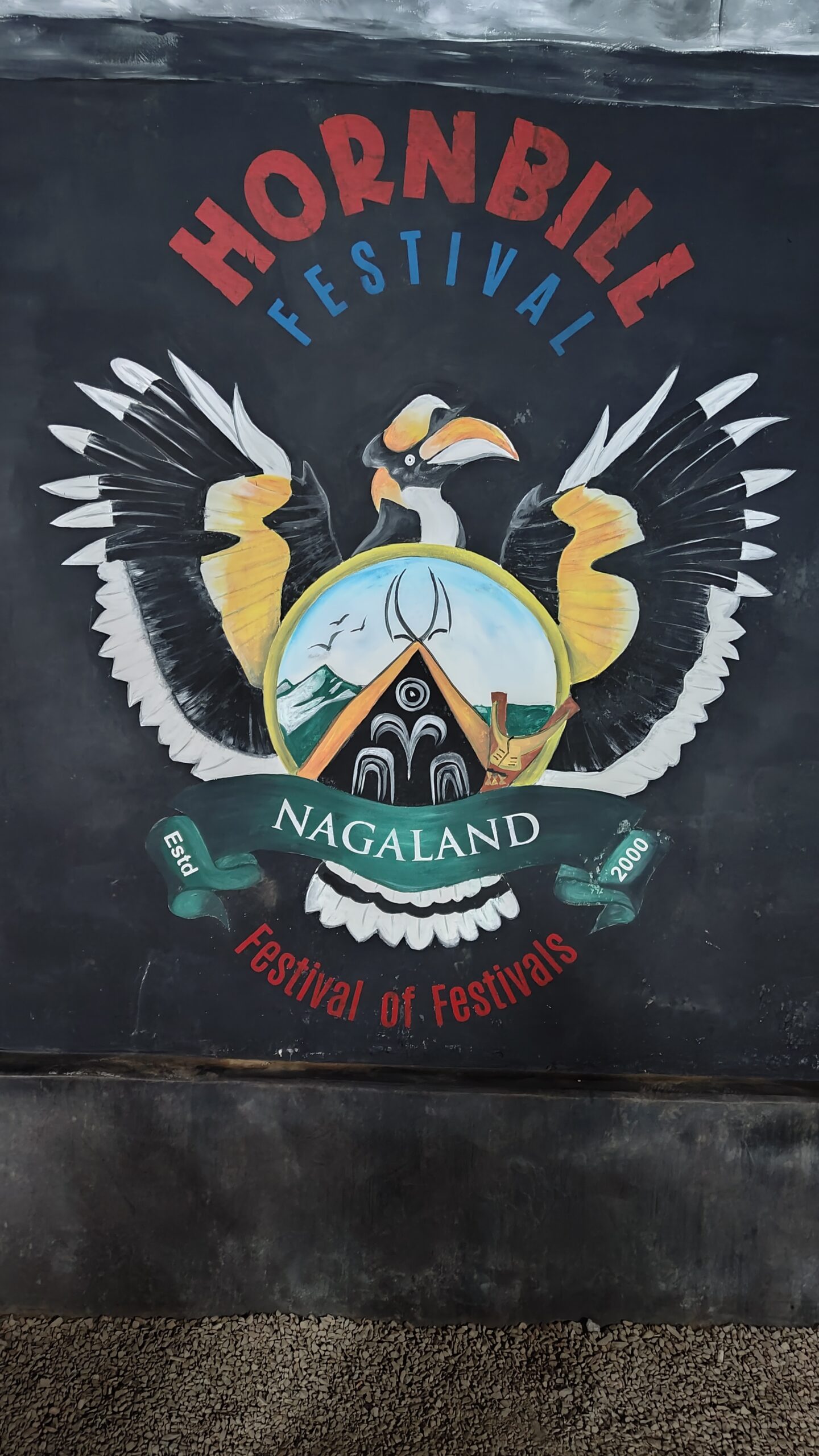
Tour of Nagaland 2022 | Day 12 | Dimapur – Kohima | 70 kms
After 3 nights of sleeping in a tent, finally I had a comfy bed last [...]